
Guarantor: Ing. Kamil Plaček
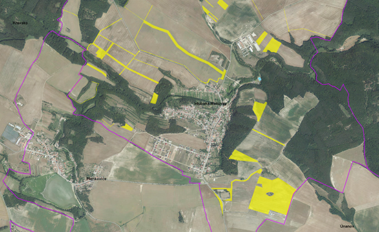
The purpose of ÚAP is to identify and evaluate the condition and development of the land – its value and the limits of its use, plans for making changes in the land, and problems that need to be resolved in the planning documentation (ÚP). ÚAP includes data obtained from providers, as well as field survey. This data is processed into data models to create technical documentation.
Analysis of the sustainable development of the area
ÚAP also includes a sustainable regional development analysis (RURÚ) divided into 10 thematic areas, which describe the three pillars of sustainable development – environmental, economical and socio-demographic.
All themes contain the characteristics of the current state and development of the area and an evaluation of defined indicators. The outputs of RURÚ include a SWOT analysis (analysis of strengths, weaknesses, opportunities and threats), identification of problems dealing with spatial development documentation, and an evaluation of the equilibrium between the pillars of sustainable development elaborated on the basis of a selected group of indicators.
Analysis of the sustainable development of the area for municipalities
We can commence working with RURÚ at the level of municipalities, where the results of RURÚ are elaborated in detail for each entity of the municipality with extended power.
The elaboration of RURÚ results in a questionnaire, publicly accessible data, information from municipality representatives and field studies. The outputs are municipality briefs that include description of the municipality (environment, infrastructure, population, developed areas, amenities, etc.), faults, threats, potential problems of development, proposals and recommendations for planning, projects, SWOT statements and photo documentation.
Service contents
Regular updates allow us to provide technical assistance that includes
- processing data from providers into ÚAP model,
- processing missing phenomena (character of the landscape, defining floodplains, the cultural and historical values of the area) or phenomena discovered during research,
- creating and printing drawings,
- preparing a sustainable development analysis of the area (RURÚ).
For processing RURÚ at the level of individual municipalities, we provide
- processing of questionnaires,
- conducting field research, including photo documentation,
- drawing up reports.
Who is this service intended for
Our clients are spatial planning and building rules offices of the municipalities with extended power.
Experience
We have been elaborating ÚAP since 2006, when we took part in verifying ÚAP for pilot areas (cities of Uničov and Litovel).
Since the new Act on Spatial Planning and Building Rules went in force, we have taken part in acquiring or updating ÚAP for 28 cities in the regions of Moravia-Silesia, Olomoucko, Zlínsko, South Moravia, Plzeňsko, Pardubicko, Královéhradecko and Vysočina.
In 2016, we provided technical assistance in updating ÚAP for the cities of Hořice, Nová Paka, Moravská Třebová, Náchod, Znojmo, Ivančice, Lipník nad Bečvou and Frýdek-Místek.
RURÚ elaborated at the municipal level:
- Sustainable development analysis of the area for individual municipalities of SO ORP Plzeň, 2009, 2014, 2016
- Sustainable development analysis of the area for the municipality of Háj ve Slezsku and Jakartovice, 2013
 Jsem na Facebooku