
We have a long-term stable position in the area of elaborating proposals and in creating and implementing IACS and LPIS in Member and Candidate States of the EU. We prepare studies and projects aimed at agricultural-environmental measures, especially in the context of Rural Development Program measures, but also with the harmonization of requirements for farm management and environmental protection and with Good Agricultural and Environmental Conditions (GAEC).
Who is this service intended for
Key clients in the Czech Republic are the Ministry of Agriculture and the State Agricultural Intervention Fund. They also include the ministries of agriculture and paying agencies of other Member and Candidate States of the EU.
Service contents
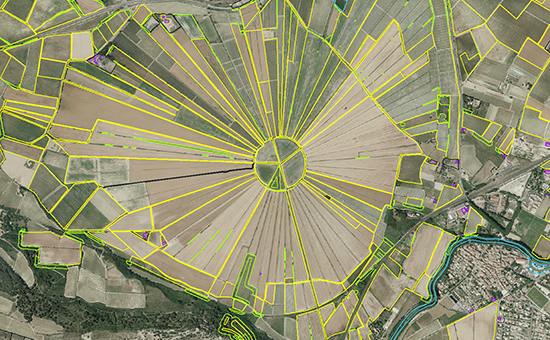
- Creating the Land Parcel Identification Service (LPIS) and Integrated Administrative and Control System (IACS) based on the current requirements of EU legislation and national requirements
- Analyzing the organizational structure and technical sources required for the development and subsequent support of LPIS and IACS
- Preparing the technical specifications and tender documentation for processing spatial data (digital aerial photo maps, digital terrain models, LPIS vectoral data), software and hardware for LPIS and IACS
- Training for administrative staff, consultants and advisers
- Creating large geographic databases (LPIS reference parcels, landscape components, thematic layers to protect the landscape and environment)
- Consultation with farmers during the creation of LPIS
- Monitoring and evaluating the quality of data and processes associated with LPIS and IACS
- Studies and evaluations of cross-compliance and measures of the Rural Development Program (RDP)
- Research projects in the implementation of the Common Agricultural Policy (CAP)
- We are also able to perform tasks of a sectional nature:
- Continuous analysis of relevant EU legislative regulations and related documents
- Analysis of national legislation in selected member states and candidate countries of the EU
- Active participation in conferences, workshops and working meetings organized by the European Commission (DG JRC and DG AGRI) since 2000
- Identification of “best practices” in member states of the EU
Experience from the Czech Republic
- Proposal and creation of IACS and LPIS in the Czech Republic – complete technical support, 2000–2002
- Methodological and technical support in the preparation of LPIS for the first subsidy campaign after joining the EU in 2004, 2003–2004
- Analysis and proposal of monitoring for the Rural Development Program, 2005–2006
- Research studies and pilot project for the implementation of Good Agricultural and Environmental Conditions (GAEC) in relation to landscape components, 2006
- Ex-post evaluation of the Rural Development Horizontal Plan 2004–2006, 2008–2009
- Analysis of selected parts of LPIS in order to ensure compliance with EU requirements, analysis of the data, organizational structure and division of responsibilities between concerned institutions, 2013
- Impact analysis of CAP reforms and definition of requirements and standards for new LPIS 2015, 2014
- Ex-post evaluation of the Rural Development Horizontal Plan 2007-2013, 2016
Experience from abroad
- Design, creation and implementation of IACS software, Slovakia, 2002–2003
- Technical support in the development of IACS software, Hungary, 2003–2005
- Digitalization of LPIS in the southeast part of Romania, 2006
- FieldFact – international research project (sixth framework program EU) aimed at applying the GALILEO satellite navigation system in agriculture, 2006–2009
- Technical support in the design of IACS and LPIS in Turkey, including the preparation and implementation of the pilot project, Turkey, 2007
- Technical support in the design of LPIS, including the preparation of the methodology and technical specifications, LPIS data quality control, hardware and software testing and training, Macedonia, 2008–2010
- Support for the establishment of a fully operational paying agency in line with EU standards, including the design, creation and implementation of IACS software, internal IT audit, and the preparation and realization of the information system
- IACS campaign, Croatia, 2010–2012
- Study on the delimitation of nitrate vulnerable areas and economic impacts of implementing the Nitrate Directive in Croatia, 2011–2012
- Further development of LPIS aimed at updating LPIS, modification of the defined IT platform, development and strengthening of human resources capacities in LPIS management and strengthening the cooperation and exchange of information between institutions, Macedonia, 2013–2014
- Technical support for the creation of capacities in the paying agency of Croatia in the preparation of the new reform of CAP and CFP, 2014–2016
- Revision of the database of agricultural land parcels 2015 – updating and supplementing LPIS, digitalization of non-agricultural landscape components, project for the National Institute of Geographic and Forestry Information (IGN), France, 2014–2015
- Updating the Agricultural Information System (AIS) and setting up a data exchange system between the Ministry of Agriculture and other relevant institutions, Macedonia, 2016–2017
 Jsem na Facebooku